Bridging Physical and Digital Environments
Course Title
Bridging Physical and Digital Environments through Participatory Spatial Design
Course Description of Regional Living Lab
The proposed Regional Living Lab explores how spatial design, digital technologies and real-world experimentation can support the participatory development of a detailed development plan for the Vägga area in Karlshamn. The course focuses on designing and testing hybrid physical–digital tools and methods that strengthen planning processes, with particular emphasis on involving target users in actively used public spaces such as sports and recreational environments.
Rather than addressing an undefined problem, the course is embedded in an ongoing municipal planning process, where Karlshamn Municipality is preparing a formal planning framework for Vägga. The area is already intensively used for sports, leisure, and outdoor activities, making it a dynamic and socially significant environment. The task is therefore an explorative planning activity to enable participation in new ways to support the structured development of an existing, highly valued landscape.
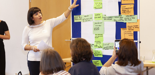
Within this context, the Living Lab investigates how interdisciplinary approaches can enhance planning practices, particularly by introducing digital tools that enable special proposals and stakeholder engagement.
The course positions itself at the intersection of formal planning processes and experimental design methods, allowing students to contribute exploratory proposals, prototypes, and scenarios that can inform decisionmaking.
Learning Outcomes
Knowledge and understanding
On completion of the course, the student will be able to:
- Describe how digital and interactive tools (e.g. AI, XR, sensor-based systems) can support critical, evidencebased, and participatory approaches in spatial planning
- Explain how digital information can be translated into spatial form and embedded in physical environments to support planning and design processes
- Demonstrate understanding of how digital technologies influence contemporary planning practice, particularly in relation to communication, digital prototyping and stakeholder engagement
Competence and skills
On completion of the course, the student will be able to:
- Apply selected digital tools to collect, analyze, visualize, and communicate spatial data and planning proposals
- Develop iterative digiphysical prototypes, integrating spatial design with digital interaction (e.g. XR environments, sensor-based interfaces)
- Design and test interactive spatial solutions based on identified use situations, including translating digital information into physical or hybrid environments
- Collaborate in interdisciplinary teams to integrate spatial, technical, and user-oriented perspectives in planning and design processes
Judgement and approach
On completion of the course, the student will be able to:
- Critically assess the potential and limitations of digital and interactive tools in spatial planning, including their role in real-world decision-making
- Reflect on ethical, social, and communicative aspects of digital technologies, including accessibility, inclusion, and user engagement (with particular attention to youth perspectives)
- Evaluate how digital interventions contribute to sustainable, inclusive, and aesthetically meaningful environments, in line with New European Bauhaus values
- Reflect on the relationship between physical and digital space, and the implications of hybrid environments for future planning practices
Prerequisites for the Course
Students from the Department of Spatial Planning should have basic knowledge of spatial design and prior experience with studio-based project work on master level.
Students in Computer Science and Software Engineering should have fundamental knowledge of AI concepts, algorithms, system architecture, and data processing. Mechanical Engineering students should have fundamental knowledge of sensor integration in combination with physical and rapid prototyping. Depending on the respective focus of the programmes, students also contribute with experience in 3D-modelling, Game engines, Web programming, and XR development.
In addition, students should have a willingness to work in cross-disciplinary teams and navigate open-ended, exploratory design processes.
Registration Info and Deadline
At a Glance
| Where | Blekinge Institute of Technology |
| Name of lecturer(s) | Josefin Westerlund, Andrea Gimeno Sanchez and Malin Larsen Department of sparial planning. Linus de Petris, department of computer science; Torbjörn Fridensköld and Fredrik Gullbrandsson, department of software engeneering; Peter Blaschke; innovation lab |
| Open for students from faculties/degree programmes | Spatial planning, software engineering and computer science |
| Time period | Starts november 2026 and ends june 2027 |
| Year | |
| Planned format | Seminar, Workshop, Lecture, Project |
| Required study level(s) | Master and 3rd year bachelor |
| ECTS | 5 ECTS total |
| Registration info and deadline | |
| Contact person | Malin Larsen: malin.altenby.larsen@bth.se, Josefin Westerlund: josefin.westerlund@bth.se |

Stay Tuned!
Listen to our BAUHAUS4EU Podcast and sign up for our newsletter – stay up to date on all of our ongoing developments and planned activities!
Download Area
In the Download Area, you can find our communication kit, logos, deliverables and other useful documents.


